Hurricane Teddy is expected to reach Atlantic Canada as a post-tropical storm on Wednesday morning and will most likely have decreased wind speeds compared to Hurricane Dorian in 2019.
Nova Scotia and Prince Edward Island should expect surge levels in addition to flash flooding due to intense rainfall. Current estimates are between 3-5 meters of surge for Prince Edward Island and 3-9 meters for Nova Scotia. Parts of Newfound and Labrador are also expected to receive rainfall of 50mm-100mm.
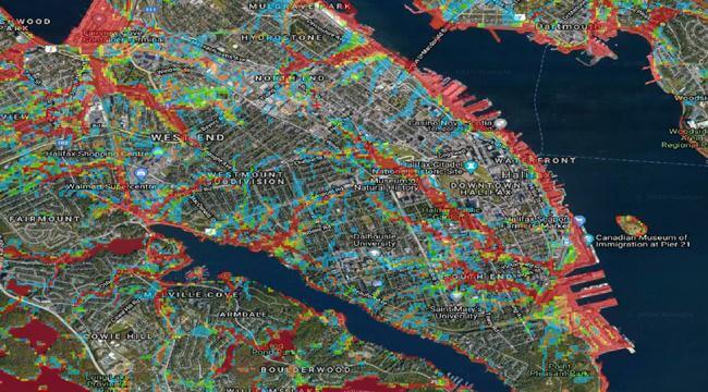
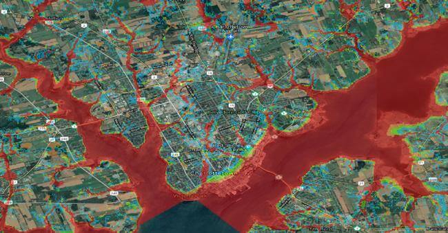
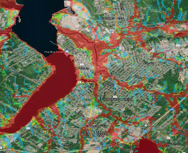
CoreLogic estimated the flood risk in different parts of Nova Scotia and Prince. The red in the maps below reflect extreme risk, orange is very high risk, yellow is high risk, green is moderate risk and blue is low risk.
Flood Risk in Halifax, Nova Scotia

Flood Risk in Charlottetown, Prince Edward Island

Flood Risk in Sydney, Nova Scotia

Overall, we should less impact from wind gusts but rainfall and surge are expected to cause flooding through Nova Scotia, Prince Edward Island, and Newfoundland and Labrador over the next few days.
CoreLogic will provide updates on the situation as it unfolds.


